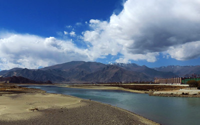
Lhasa River is also called Kyichu River. Originating from the middle part of the Nyainqentanglha Mountain's north face, Lhasa River flows through Meldro Gungkar County, Dagze County and Lhasa City. At last , it eventually merges into Yarlung Tsangbo River. As the longest tributary of Yarlung Tsangbo River, it drains an area of about 32,471 square kilometers, around 13.5 percent of Yarlung Tsangbo River’s drainage area.
Legend and History
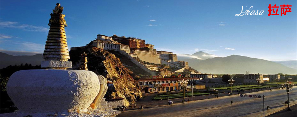
 Lhasa River is called Kyichu River in Tibetan language, which means “Happy River”. There is a saying that an ancient clan named Kyichu once lived along the river, hence its name. Lhasa River had a great influence on Lhasa City's development. In 633 AD, Songtsen Gampo moved the capital to Lhasa River Valley, which gradually developed into the political, economic and cultural center of Tibet. With an area of approximately 6,178 square miles (16,000 square kilometers), it supports a population of around 600,000. It is famed as one of the three largest granaries in Tibet. The other two are Nian-Chu River Valley and Yarlung Tsangbo River Valley.
Locals love Lhasa River very much. At weekends or during holidays, they go camping and fishing on the riverside and even bathe in the river. Meanwhile, they don’t forget to enjoy
Tibetan butter tea and delicious food brought from home. For visitors, there are some other attractions along the river, which deserve a visit.
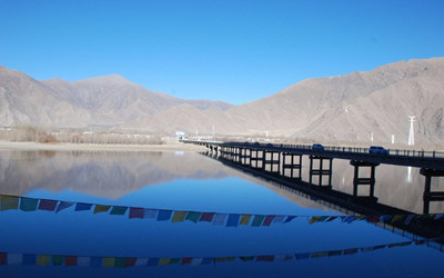
Around one mile (1.6 kilometers) from
Lhasa Railway Station and three miles (4.8 kilometers) from the downtown area, it is actually a single-track railway bridge of the
Qinghai-Tibet Railway. It’s around 3,047 feet (928.85 meters) long with the longest span of 354 feet (108 meters). The main bridge is a hybrid system of five large spans made of continuous girders and three concrete-filled steel tube arches. Today it has become a landmark of the
Qinghai-Tibet Railway as well as Lhasa City.
Sichuan-Tibet & Qinghai-Tibet Highways Monument
Situated next to Lhasa River in the south of Lhasa city, the monument was built on December 25, 1984, to commemorate the three thousand soldiers of the People’s Liberation Army who sacrificed their lives for the Sichuan-Tibet and
Qinghai-
Tibet Highways' construction. The construction of these two highways started separately in April and June of 1950 and was finished at the same time on December 25, 1954. By far, the Sichuan-
Tibet and Qinghai-Tibet Highways still serve as two very important transport routes in Tibet.
Qushui Water Burial Platform
Passing the Qushui Bridge, located about 40 miles (60 kilometers) to the southwest of Lhasa, one can see a stone platform on the Lhasa River bank, where water burial is held. To be precise, it is at the junction of Lhasa River and Yarlung Tsangbo River.
The water burial platform is elaborately selected. The living Buddha or eminent monk starts an on-the-spot investigation first and then prays and asks the Buddha for an oracle. Besides, it should be far away from residential areas and drinking water source. The best location is a platform near the river torrents or the junction of two rivers.
Water burial is observed by Tibetans and Monba people. They use yaks to carry the dead to the waterfront and invite lamas to recite sutras to release their souls from suffering. Afterwards, dead bodies are thrown into the river to feed the fish. Local people think fish are the deities' incarnations, therefore they never eat them.Water burial is considered inferior to sky burial. To practice sky burial, the dead man’s family needs to invite a sky burial master and a man to carry the body. The poor can’t afford the cost of sky burial so that they choose water burial instead.
Travel Tips
Name: Lhasa River, Kyichu River
Chinese Name: 拉萨河
Length: 342 miles (551 kilometers)
Altitude: 11,745 to 17,060 feet (3,580 to 5,200 meters)
Add: In Lhasa City, Tibet
Entrance Fee: free
Opening Hours: all day
Transportation: Take bus no. 4, 6, 8, 10, 12 or 17 and get off at Youche Zongzhan Station. Then walk south for about 300 yards (274 meters) to reach the riverside.

 Lhasa River is called Kyichu River in Tibetan language, which means “Happy River”. There is a saying that an ancient clan named Kyichu once lived along the river, hence its name. Lhasa River had a great influence on Lhasa City's development. In 633 AD, Songtsen Gampo moved the capital to Lhasa River Valley, which gradually developed into the political, economic and cultural center of Tibet. With an area of approximately 6,178 square miles (16,000 square kilometers), it supports a population of around 600,000. It is famed as one of the three largest granaries in Tibet. The other two are Nian-Chu River Valley and Yarlung Tsangbo River Valley.
 Lhasa River Bridge
 Ask Questions ?