- Home
- Province Guide > Qinghai >
Bayankala Mountain

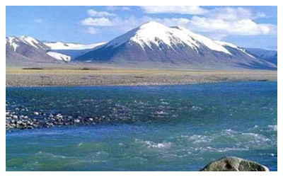
Bayankala Mountain, located in the south-central part of Qinghai Province, is the southern branch of Kunlun Mountains. This is the watershed of the the Yangtze River source area and the Yellow River source area . The Yokuzonglie Canal at the north foot is the source of the Yellow River, and the south foot is the north source of the Yangtze River.
Bayankala means “rich green and black mountain” in
Mongolian. Bayankala Mountain is 5,000-6,000 meters above sea level. The northern slope is gentle, the southern slope is deep with many valleys. With higher mountainous terrain, it is cold and belongs to the high desert grassland climate. The population here is scarce. Only
Tibetans are engaged in animal husbandry.
Many high mountains are covered with snow all year round, and glaciers hang everywhere in the mountains. After the spring of each year, under the strong sunlight, the ice and snow on the mountains gradually melt, the melted water merges into a stream to moisten the dry fertile soil and supply water for the Yangtze River and the Yellow River.
Travel Tips
Address: Located in Suohurima Township, Jiuzhi County, Guoluo
Tibetan Autonomous Prefecture,
Qinghai Province
Opening hours: open all day
Admission: free
 Bayankala Mountain, located in the south-central part of Qinghai Province, is the southern branch of Kunlun Mountains. This is the watershed of the the Yangtze River source area and the Yellow River source area . The Yokuzonglie Canal at the north foot is the source of the Yellow River, and the south foot is the north source of the Yangtze River.
 Ask Questions ?