Skype: neodalle-travel
Tel: +86 135 7447 2266
E-mail: sales@visitaroundchina.com
 Huangnan Tibetan Autonomous Prefecture is seated in the southeast region of Qinghai Province, neighboring Haidong Perefecture in the northeast, Hainan Tibetan Autonomous Prefecture in the northwest and Guoluo Tibetan Autonomous Prefecture in the southwest. It also shares boundary with Gansu Province in the southeast.
History of Huangnan
Before the Western Han Dynasty (206BC-24AD) conquered it in 61BC, Huangnan region was inhabited by the Qiang people, an ancient tribe in western China. One year after the subjection, Heguan County was established there. It was once the domain of Tubo regime in Tibet during the Tang Dynasty (618-907). Huangnan Tibetan Autonomous Prefecture was established in 1955.
What to see in Huangnan?
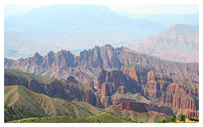
Huangnan Prefecture lies in the plateau area in southern Qinghai. With the Maixiu Mountain in the center as a limit, the south region of Huangnan is simple and haploid in geology. The terrain slopes gently to the north and the east and there are vast grassland distributed, while the northern part is precipitous with many high mountains, gorges and mesas between mountains. Here lists top attractions in Huangnan.
 |
 |
 |
| Kanbula National Geo-Park | Longwu Monastery | Wutun Monastery |
When to visit Huangnan?
Huangnan Prefecture enjoys a continental plateau climate with clear dry and wet seasons, long, chilly and dry winter and short, refreshing and humid summer. The annual average temperature of Huangnan weather range of the whole prefecture is around -0.9ºC to 8.5ºC. July to September is the best period to visit Huangnan Prefecture.
How to reach Huangnan?
The only means to travel around Huangnan Prefecture is by bus. Anchored by the county seats of each county, the transportation is not troublesome because noted scenic spots are all not far away from these county towns. Highways connect the prefecture with Xining, the capital city of Qinghai Province, Xiahe county, and Linxia Hui Autonomous Prefecture in southern Gansu. Xining is about 181 kilometers (112 miles) from Huangnan, about four hours drive.
Huangnan Travel Tips
Special Local Products: orange, Mabao (fungus), Chinese caterpillar fungus.
China Post: 51, Xiaqiong Zhong Lu, Longwu Town, Tongren County
Useful Telephone Numbers:
Tourist Complaints: 0973-8728181
Weather Forecast: 121
Zip Code Inquiry: 184
 Ask Questions ?